Issue 2(62)/2020
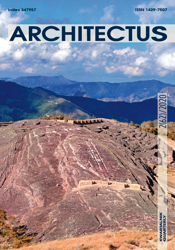
Table of contents
Open table of contents
- Albert Meyers - El Fuerte de Samaipata in context. Introduction
- Mariusz Ziółkowski - El Fuerte de Samaipata in the light of current research
- Jacek Kościuk, Mariusz Ziółkowski, Bartłomiej Ćmielewski, Delfor Ulloa Vidaurre - Samaipata project – aim of the research, methodology, and methods of documentation
- Jacek Kościuk, Mariusz Ziółkowski, Bartłomiej Ćmielewski, Delfor Ulloa Vidaurre - 3D terrestrial laser scanning of El Fuerte de Samaipata
- Jacek Kościuk, Mariusz Ziółkowski, Bartłomiej Ćmielewski, Delfor Ulloa Vidaurre - 3D terrestrial laser scanning of El Fuerte de Samaipata
- Jacek Kościuk, Małgorzata Telesińska, Maciej Nisztuk, Marta Pakowska - Documentation of the most important petroglyphs by structured light scanning and analysis of the most damaged petroglyphs by vPTM and vRTI methods
- Jacek Kościuk, Mariusz Ziółkowski, Marta Pakowska - Formal and iconographic analysis and interpretation of the most damaged petroglyphs
- Janusz Kogut, Jacek Kościuk, Anna Kubicka - Interpretation of traces of hypothetical quincha walls in Samaipata
- Jacek Kościuk, Giuseppe Orefici, Mariusz Ziółkowski, Anna Kubicka, Rosario Muñóz Risolazo - Description and analysis of El Fuerte de Samaipata in the light of new research, and a proposal of the relative chronology of its main elements
- Anna Kubicka, Jacek Kościuk - Determining the rate of erosion and lichen spread on Samaipata rock by comparing 3D laser scan results from two different surveying epochs
- Wojciech Bartz, Jacek Kościuk, Maria Gąsior, Teresa Dziedzic - Petrographic, mineralogical, and climatic analyses, and risk maps for conservation strategies
- Izabela Wilczyńska, Paweł Bronisław Dąbek, Bartłomiej Ćmielewski, Jacek Kościuk - Integration of project results on a GIS platform and its impact on conservation strategies
Articles
Albert Meyers - El Fuerte de Samaipata in context. Introduction
doi:10.37190/arc200202
This article offers an introduction to the El Fuerte de Samaipata site as a unique example of pre-Hispanic cultural heritage in Bolivia, and discusses the importance of current research for the conservation and preservation of the site. The rock carvings and the actual rock on the site have to be viewed in correlation with the adjacent architectural remains and the landscaping and seen as a complete unit. A summary of current knowledge concerning the site is presented, and it shows that the scale of the rock art at Samaipata has no parallel in the Americas, as specified in the description of the site on the UNESCO World Heritage List. The site has been compared to some sites in Bolivia and Peru in terms of the problems facing the protection of heritage monuments. The new approach guided by the Polish mission for research on the architecture and rock art of the site is well justified by themethods and methodology used for its comprehensive documentation.
Keywords:
Download article
Mariusz Ziółkowski - El Fuerte de Samaipata in the light of current research
doi:10.37190/arc200203
Samaipata, or more precisely El Fuerte de Samaipata, is a pre-Hispanic archaeological site of approximately 40 ha located in Bolivia, on the easternslopes of the Andes. Due to its artistic and historical importance, the site was inscribed on the UNESCO World Heritage List in 1998. The importance of El Fuerte de Samaipata and the history of the investigations of this emblematic place have been the subject of numerous works. This text summarises the main stages of the studies of the site, particularly of the rock, from the first information in Colonial sources of the 16th century to the most current research carried out by Bolivian and foreign scholars. Special emphasis is given to the documentation and preservationprograms of the petroglyphs, which are deteriorating due to environmental and anthropic factors.
Keywords:
Download article
Jacek Kościuk, Mariusz Ziółkowski, Bartłomiej Ćmielewski, Delfor Ulloa Vidaurre - Samaipata project – aim of the research, methodology, and methods of documentation
doi:10.37190/arc200204
The Samaipata project concerns one of Bolivia’s most important monuments – El Fuerte de Samaipata, a UNESCO World Heritage Site. This paper describes the origin of the project, the reasons behind starting it, and its main goals. In addition, the documentation, surveying and analytical methods used in the project are briefly described.
Keywords:
Download article
Jacek Kościuk, Mariusz Ziółkowski, Bartłomiej Ćmielewski, Delfor Ulloa Vidaurre - 3D terrestrial laser scanning of El Fuerte de Samaipata
doi:10.37190/arc200205
This paper concerns El Fuerte de Samaipata – one of Bolivia’s most important monuments inscribed on the UNESCO World Heritage List. The study describes the hardware and software used in the project “Architectural examination and complex documentation of Samaipata (Fuerte de Samaipata/Bolivia) site from the World Heritage List”, as well as the workflow adopted for the terrestrial laser scanning (TLS) of the site. It also explains theimportant role that TLS played in the entire project.
Keywords:
Download article
Jacek Kościuk, Mariusz Ziółkowski, Bartłomiej Ćmielewski, Delfor Ulloa Vidaurre - 3D terrestrial laser scanning of El Fuerte de Samaipata
doi:10.37190/arc200206
The El Fuerte de Samaipata site inscribed on the UNESCO World Heritage List presents a pre-Columbian, multicultural history on the surface of a big sandstone rock. There are several ways of creating precise, high-resolution documentation of this rock, including classic geodetic surveys, modern high-definition surveying (terrestrial laser scanning), and close-range photogrammetry. Close-range photogrammetry is a low cost technique, and the detailed RGB documentation provided by it aids architectural and archaeological research. This paper presents the results of the application of close-range photogrammetry in different light bands (visual, infrared, and thermal). Sony ILCE-7RM2, Parrot Sequoia, and Flir Tau2 cameras were used. The authors obtained over 50 thousand images and over 27 thousand multispectral images (multiplied by four bands, which gave over 100 thousand single band images). The multispectral and thermal data enabled risk maps to be created for conservation purposes.
Keywords:
Download article
Jacek Kościuk, Małgorzata Telesińska, Maciej Nisztuk, Marta Pakowska - Documentation of the most important petroglyphs by structured light scanning and analysis of the most damaged petroglyphs by vPTM and vRTI methods
doi:10.37190/arc200207
The case being studied is one of Bolivia’s most important monuments – El Fuerte de Samaipata, a UNESCO World Heritage Site. This paper proposes a new workflow for the two most important aspects of studies on cultural heritage – detailed documentation and analysis. The former includes the well-known techniques of digital photogrammetry and structured light scanning. The latter comprises polynomial texture mapping (PTM) and reflectance transformation imaging (RTI), both of which have been used since the beginning of this century. The novelty proposed by the authors is the transfer of part of the data collection process from the physical environment to the virtual space. Despite some technical problems, by eliminating the tedious and time-consuming process of shooting photos in the field using specific lighting angles, this new workflow proved to be very efficient, particularly in documenting and interpreting badly preserved examples of bas-relief rock art.
Keywords:
Download article
Jacek Kościuk, Mariusz Ziółkowski, Marta Pakowska - Formal and iconographic analysis and interpretation of the most damaged petroglyphs
doi:10.37190/arc200208
This paper presents a study of some of the most deteriorated petroglyphs from the Samaipata Rock, and is the part of the larger research project “Architectural examination and complex documentation of Samaipata (Fuerte de Samaipata/Bolivia)”. The study involved the following three steps: 1) Searching for visualisation methods that would allow the original form of today’s indecipherable petroglyphs to be identified; 2) Identifying the original iconographic program of individual engravings; 3) Searching for possible stylistic and formal analogies in order to fit the iconographic program into the broader context of rock art in this part of South America. Due to the amount of material available and its multi-threaded nature, the study does not exhaust the topic, but only, based on some of the most characteristic examples, shows the methodological and methodical aspects of studying such petroglyphs.
Keywords:
Download article
Janusz Kogut, Jacek Kościuk, Anna Kubicka - Interpretation of traces of hypothetical quincha walls in Samaipata
doi:10.37190/arc200209
El Fuerte de Samaipata, commonly known as Samaipata, is an archaeological site in Bolivia. It was inscribed on the UNESCO World Heritage List in 1998. The most characteristic feature of the site is a natural rock that served as a wak’a (sacred place) for several local, pre-Hispanic cultures, so its current condition is the result of at least 1200 years of development. Towards the end of the 20th century and beginning of the 21st century, Samaipata was comprehensively studied and documented by German scholars. Due to the threat of progressing erosion, a new documentation project was executed by a Polish team. The main objective of the project was to document the vanishing site using 3D laser scanning. Most of the research already published on Samaipata concentrates on the complex arrangement of niches and terraces, figural and geometrical petroglyphs, as well as canals and water reservoirs at the site. The long rows of small circular holes drilled into the rock attract less scholarly attention. They are commonly associated with the vertical posts used for traditional quincha walls. Since there are doubts about the ability of the quincha wall to resist the extremely strong winds on the top of the rock, the Authors conducted computer simulations to clarify these reservations. The 3D model was based on 3D laser scanning results, while FEM was used to solve structural analysis problems.
Keywords:
Download article
Jacek Kościuk, Giuseppe Orefici, Mariusz Ziółkowski, Anna Kubicka, Rosario Muñóz Risolazo - Description and analysis of El Fuerte de Samaipata in the light of new research, and a proposal of the relative chronology of its main elements
doi:10.37190/arc200210
The study describes the results of the documentation of El Fuerte de Samaipata, a pre-Hispanic archaeological site in Bolivia on the UNESCO World Heritage List. It summarizes the most recent observations of the carvings on the rock of Samaipata, which, due to progressing erosion, are slowly vanishing. Thanks to modern documentation technologies, laser scanning, structural light scanning, digital photogrammetry, and advanced digital analysis of images and 3D models of the site, all.
Keywords:
Download article
Anna Kubicka, Jacek Kościuk - Determining the rate of erosion and lichen spread on Samaipata rock by comparing 3D laser scan results from two different surveying epochs
doi:10.37190/arc200211
The paper describes the possibility of using 3D laser scans from two different surveying epochs for structural health monitoring. It uses the results of two particular projects – the 2006 3D laser scanning of Samiapata rock by the University of Arkansas and the 2016 3D laser scanning by the Laboratory of 3D Laser Scanning at Wrocław University of Science and Technology – and discusses the methods, results, and limitations of comparing them.
Keywords:
Download article
Wojciech Bartz, Jacek Kościuk, Maria Gąsior, Teresa Dziedzic - Petrographic, mineralogical, and climatic analyses, and risk maps for conservation strategies
doi:10.37190/arc200212
El Fuerte de Samaipata is a pre-Hispanic archaeological site in Bolivia that has been on the UNESCO World Heritage List. Its main part – the rock – is densely covered with a complex arrangement of terraces, platforms, water reservoirs, channels, and petroglyphs. The rapidly progressing erosion of the rock is making the petroglyphs less and less clear, and some are no longer recognisable. The main topic of this study is to indicate all risk factors conducive to erosion and to create risk maps identifying the most vulnerable areas that require immediate conservation intervention. Parallel mineralogical and petrographic studies show that the Samaipata rock is a quartz-rich, porous, well-sorted sandstone, classified as quartz arenite or subarcosic arenite. The cement of the rock is composed of quartz overgrowth and ubiquitous, pore-filling hematite-clay aggregates containing non-expanding kaolinite, illite, and expanding smectite. The rock exhibits different stages of weathering, from relatively fresh to strongly altered and heavily cracked. In comparison to fresh rock, the latter has cement enriched in clay minerals and is depleted in hematite due to weathering and the dissolution of the iron-bearing phase.
Keywords:
Download article
Izabela Wilczyńska, Paweł Bronisław Dąbek, Bartłomiej Ćmielewski, Jacek Kościuk - Integration of project results on a GIS platform and its impact on conservation strategies
doi:10.37190/arc200213
The geographic information system (GIS) has become a very popular and useful tool to aggregate and process spatial data. In this paper, the implementation of data obtained during survey seasons at the El Fuerte de Samaipata (Bolivia) archaeological site and results of data analysis on the GIS platform are presented. In addition to the thematic layers, a description of the sectors and archaeological relics was added to the whole system. The implemented layers are related to orthoimages created from terrestrial laser scanning (TLS) and from close range photogrammetry (in visual, spectral, and infrared light), raw photos of petroglyphs, a highly detailed vector plan of the site, conservation risk maps, new spatial divisions, description layers, and a digital terrain model (DTM) based on the results of TLS. Such a system, with an implemented DTM, allows rainwater runoff and its impact on the archaeological site to be analysed. Thus, the paper presents a study on some hydrological conditions of the Samaipata rock. It is part of the larger research project “Architectural examination and complex documentation of Samaipata (El Fuerte de Samaipata/Bolivia) site from the World Heritage List”. The results of this study are considered mainly from the point of view of conservation recommendations and strategies. Same aspects, however, may influence future studies on the chronology and cultural affiliation of the Samaipata rock carvings.
Keywords:
Download article