Issue 1(77)/2024
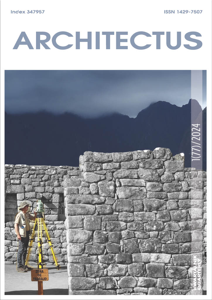
Table of contents
Open table of contents
- Teresa Dziedzic - Hatshepsut Temple in Deir el-Bahari, Egypt - research and conservation work
- Rafał Czerner - Two “Horned” Altars from the El Darazya Site at Marina el-Alamein in Egypt
- Aleksandra Brzozowska-Jawornicka - Prothyron from the Villa of Theseus in Nea Paphos, Cyprus
- Anna Kubicka-Sowińska - Delineation of buildings at Machu Picchu by Inca builders – is metrological analysis of building outlines possible without the invasive survey?
- Roland Mruczek, Tomasz Kastek - The issue of limitatio in early Silesian urban planning
- Radosław Biel - Turris latericia destructa – the court of Duchess Anna in Wrocław and the latest research
- Aleksander Limisiewicz - Medieval malt house at 24–25 Mennicza Street in Wrocław
- Bogusław Czechowicz - An imperial sigh with oriental notes? Ortenburg Castle in Bautzen (Upper Lusatia) during the reign of Kings Matthias Corvinus, Vladislaus II and Louis Jagiellon (around 1483–1526)
- Maria Legut-Pintal - Assessment of the residential space of a pre-industrial city. The example of Wrocław/Breslau in the 16th and 18th centuries
- Wolfram Hoepfner - The Pergamon Altar and the Mausoleum of Halikarnassos
- Ernest Niemczyk - The Głogów Cathedral and the Głogów Archaeological Museum
- Professor Jacek Kościuk - Our Masters
Articles
Teresa Dziedzic - Hatshepsut Temple in Deir el-Bahari, Egypt - research and conservation work
doi:10.37190/arc240101
Situated in the southern section of the Upper Terrace at Deir el-Bahari, the Hatshepsut chapel is the largest hall chapel in ancient Egyptian architecture. For over a century, archaeological and conservation efforts have been conducted at the temple and Hatshepsut chapel. Much of the research has never been published, while others are mentioned in the mission’s annual work reports. The research and conservation work at the site needs to be ordered and summarised. The article aims to aggregate and structure information on the research and conservation efforts undertaken at the Hatshepsut chapel. Over the last century, various archaeological and conservation missions have worked at the temple and contributed their findings to understand the site’s history better. However, much of the work has not been published and is only known from field notes or typescripts. The research presented in this paper highlights the limited knowledge about Hatshepsut’s chapel, particularly in terms of conservation. Egyptological, archaeological, and architectural research conducted in recent years, which is nearing completion, will provide an in-depth understanding of the largest chapel in ancient Egypt. Supplemented with relevant research, particularly in the preservation of stone and polychrome, a comprehensive conservation program can be developed, thus paving the way for the chapel reconstruction project.
Keywords:
Download article
Rafał Czerner - Two “Horned” Altars from the El Darazya Site at Marina el-Alamein in Egypt
doi:10.37190/arc240102
Relics of two portable “horned” altars made of limestone were found during the first season of research and conservation work, which began in autumn 2021 at the El Darazya – Marina el-Alamein site. The remains of a Hellenistic-Roman period town preserved here are located on the Mediterranean coast of Egypt 100 km west of Alexandria. The well-known ruins of an ancient town at the Marina el-Alamein archaeological site are 4 km east of the place. Many similarities in architectural solutions and the common construction technique indicate the co-existence of the two settlements in one historical period. Similar material culture relics and archaeological objects can confirm their functioning in the same civilisational setting and within the range of the same influences. One of these is altars, which attest to forms of worship on the one hand and artistic traditions on the other. The latter, while also remaining a reflection, on a smaller scale, of the forms of architectural decoration of the buildings, make it possible to look at them analytically as well. The conclusions presented in this article are the result of the author’s own field research at the El Darazya site.
Keywords:
Download article
Aleksandra Brzozowska-Jawornicka - Prothyron from the Villa of Theseus in Nea Paphos, Cyprus
doi:10.37190/arc240103
The aim of the paper is to present a reconstruction of a monumental gate leading to the Villa of Theseus, a Roman palace in Nea Paphos on Cyprus. During the excavations carried out near the main entrance to the residence, a set of several fragments of architectural decoration was discovered, including pieces of columns and cornices. The analysis of the architectural decoration, relics of the entrance to the palace in situ and analogies from the Roman residences made it possible to propose a reconstruction of the monumental gate leading to the compound entrance complex of the palace. It was probably designed in the form of a wide door preceded by a two-column porch crowned with a triangular pediment with a tympanum: a form that Vitruvius called a prothyron.
Keywords:
Download article
Anna Kubicka-Sowińska - Delineation of buildings at Machu Picchu by Inca builders – is metrological analysis of building outlines possible without the invasive survey?
doi:10.37190/arc240104
The metrological analysis of the Inca architectural elements at Machu Picchu using the cosine quantogram method was preceded by tests of different models of building delineation and erection, which aim to test the method’s effectiveness in detecting the quantum with a differently defined error occurring in the survey sample. The sources of such errors may lie in the work of Inca builders and the modern researcher. The measurements of the architectural elements represent data from 3D laser scanning. The data obtained in this way refer to length measures that may have been delineated using quantum: building outlines, dimensions and distribution of doorways, windows and niches. However, it is uncertain which of them were actually planned by the Inca builders using the measure we are looking for (quantum) and which are incidental or outcome values. Due to the sloping of the external walls towards the inside of the building, which was characteristic feature of Inca architecture, and the way in which the buildings were planned (on horizontal terrain, sloping terrain or with projection onto the ground), the level at which the building is available for measurement also has an important influence on the results of the analyses. This may be analogous to the level at which the building was planned, or it may be significantly above that level. As a result of these factors, the group of tests concerns theoretically predictable combinations of the ways in which the Inca buildings were delineated and the level available for measurement. Tests of the effectiveness of the cosine quantogram method for Inca building outlines have shown that if they were laid out using some fixed measure (quantum) then, regardless of how the building was delineated: levelled terrace, sloping ground, projection from level to sloping ground, the cosine quantogram method must reveal its existence.
Keywords:
Download article
Roland Mruczek, Tomasz Kastek - The issue of limitatio in early Silesian urban planning
doi:10.37190/arc240105
The economic and legal changes taking place in Silesia during the times of melioratio terrae undoubtedly brought a revolution in the cultural landscape. The concept of a border in the non-urbanized space of the early Middle Ages had a completely different dimension than its foundation counterpart. The rapidly progressing colonization campaign and the development of large monastic land ownership resulted in a significant density of the settlement network, as well as a change in the ownership structure of the land itself, which was increasingly equipped with immunity. The borders – previously of a blurry, strip-like nature – increasingly took on a linear, precisely defined course. The culmination of this process was the marking of the boundaries of the chartered city (fossata), soon consolidated by city fortifications. Our study is an attempt to outline the issues of more recent research on the matter of the boundaries of a medieval city, which are the result of the progressive stratification of the settlement space in Silesia. The presented case study was intended to draw attention to new, surprising discoveries showing the evolutionary transition from the strip-like, highly conventional nature of early medieval borders to linear delimitations typical of the late and declining Middle Ages. The presented sketch is based on the results of more recent archaeological and architectural research conducted in Silesian cities, as well as analyzes of historical and iconographic sources. It is the first part of a series devoted to the stratification of urban space in the Middle Ages. The fortifications of individual elements of the early medieval Wrocław agglomeration, which had different owners, are still an open research problem, although their existence cannot be questioned today. In turn, marking the boundaries of the chartered city in the form of a rampart and moat had primarily legal and administrative significance and, in this sense, separated the area endowed with immunity from the space covered by princely law and its burdens. In the case of Wrocław, however, the flood protection and later defensive nature of the newly built structures were at least as important.
Keywords:
Download article
Radosław Biel - Turris latericia destructa – the court of Duchess Anna in Wrocław and the latest research
doi:10.37190/arc240106
In 2020, architectural relics were identified in the crypts of St Matthias Church in Wrocław, located in the centre of the riverside area of the left bank of the river, known in historiography as the princely grounds, some of which had so far escaped the attention of researchers. However, a synthetic study of the entire hospital and monastery complex of the Knights of the Cross with the Red Star, carried out as part of the author’s doctoral thesis, has shown that the discovered foundations may be the remains of a completely different, older building. On the basis of an analysis of historical records, the specifics of the building, the stratigraphy of the layers, the discovered movable historical material, palaeoenvironmental data and comparisons with other buildings of this type, it was hypothesised that the discovered building may be part of the “court of Princess Anne”, or even identical to the “destroyed tower” (turrem latericam destructa) mentioned in a document from 1253. In addition, it has been hypothesised that the tower may have been destroyed in the 1240s or 1350s, possibly as a result of the Tartar invasion of 1241. It was only after this event that St Matthias Church and other accompanying buildings were erected on the site in question, which were then given to the hospital and the order. This article presents the status of the research to date, the methods used, the interpretation of the discoveries made and the conclusions, shedding new light on the less explored history of the development of this part of medieval Wrocław.
Keywords:
Download article
Aleksander Limisiewicz - Medieval malt house at 24–25 Mennicza Street in Wrocław
doi:10.37190/arc240107
The study concerns excavations carried out in the courtyard of the “Lord’s Malt House” located at 24–25 Mennicza Street in the Old Town of Wrocław, within the Malt House Quarter. They covered an undeveloped space measuring 24 m ×20 m. They were interpreted as the location of an earlier, medieval malt house. Archaeological investigations were carried out to determine the function and chronology of the uncovered objects. Some of them were related to the Renaissance “Lord’s Malt House”: a ceramic water pipe, an end casting, four negatives of pillars placed at the entrance to the malt house, presumably used to fix a crane intended for transporting building materials and grain and malt. The last structure, a well, functioned until the construction of the waterworks (first half of the 17th century) The other cavities were associated with the medieval malt house. It consisted of two production runs terminating in malt vats.
Keywords:
Download article
Bogusław Czechowicz - An imperial sigh with oriental notes? Ortenburg Castle in Bautzen (Upper Lusatia) during the reign of Kings Matthias Corvinus, Vladislaus II and Louis Jagiellon (around 1483–1526)
doi:10.37190/arc240108
The castle in Bautzen was built on the site of an older residence under the supervision of the royal mayor of Upper Lusatia, Georg von Stein, in the years 1483–1490. Its best-preserved element from those years is the gate tower, housing the chapel of St. George on the first floor. The façade of the tower turns towards the city with the collegiate church with a spectacular monument to King Matthias from 1486, shown not only as the ruler of Bohemia and Hungary, but also as an aspirant to the imperial throne. Emphasizing the majesty of the ruler was directed primarily towards the Bautzen chapter, which included clergy associated with the Meissen bishopric, whose center – Meissen – was closely associated with the Wettins. Their territorial ambitions in the Bohemian Crown were consistently limited by Matthias. The creation of such a unique monument to the ruler in public space, which in Central Europe has only precedents in the monuments of Emperor Frederick III in Wiener Neustadt and George in Prague, could also be related to the desire to demonstrate Matthias’s rights as the Bohemian king to the then virtually lost fief of the Bohemian Crown – Luxembourg. The last representative of this dynasty, Elizabeth of Zgorzelec, daughter of Jan Zgorzelecki, handed them over to the dukes of Burgundy, but after the death of the daughter of the last of them, Maria, in 1482, these rights were taken over by the Habsburgs, who were then in sharp conflict with Matthias. Ortenburg Castle glorified Matthias not only as a potential emperor, but also as a new David or Solomon. The castle tower was probably topped with a turret known from the “Tower of David” in Jerusalem. The architectural detail in the chapel also seems to be a discreet reference to oriental architecture. In the years 1520–1527, the top of the tower was changed and an attic with six pinnacle turrets was added. This number most likely referred to the union of six cities to which Bautzen belonged. The royal mayor of Upper Lusatia was then Prince Karol Minsterberski of Ziębice, who was expanding his castle in Ząbkowice Śląskie at that time. Its facades were also topped with an attic. In this castle, like in many others from that time, references to Jerusalem and Solomonic architecture were also found. The Ortenburg Castle in Bautzen should also be added to this list, despite the “redrafting”.
Keywords:
Download article
Maria Legut-Pintal - Assessment of the residential space of a pre-industrial city. The example of Wrocław/Breslau in the 16th and 18th centuries
doi:10.37190/arc240109
Social inequalities in cities had their spatial dimension already in pre-industrial times. The quality of living space in a historic city was influenced by various factors, such as distance from the city centre, proximity to infrastructure, access to water, trade routes, markets, as well as unfavourable or oppressive neighbourhoods. The value of the properties depended on their function, the structural condition of the buildings, the size of the structures and the plots. In this paper, we proposed a method to evaluate and valorise the residential space of a pre-industrial city based on an assessment of its use value. We carried out an exemplary analysis on the example of Wrocław, a medium-sized city in Central Europe. We used historical, archaeological, iconographic data and geospatial analyses developed in a geographic information system environment. We carried out the evaluation within individual factors for a city divided into building blocks for two periods – around 1550 and around 1750. By comparing the results for these two periods, we attempted to trace the changes that occurred as a result of the city’s development and historical events. The overall picture allowed us to create a characterisation of residential space across the city. We verified the method by comparing the results obtained with data from tax records. The result obtained is consistent with knowledge of the spatial distribution of wealth in the city, indicating that the model can be applied to the analysis of other cities where tax records have not been preserved.
Keywords:
Download article
Wolfram Hoepfner - The Pergamon Altar and the Mausoleum of Halikarnassos
doi:10.37190/arc240110
Download article
Ernest Niemczyk - The Głogów Cathedral and the Głogów Archaeological Museum
doi:10.37190/arc240111
This outline is an attempt to show the beginnings of the wide-ranging archaeological and architectural research of the Old Town of Głogów, almost completely destroyed as a result of the defense of Festung Glogau in 1945, carried out under the leadership of Professor Tadeusz Kozaczewski, in which the author participated since his studies at the Faculty of Architecture of the Wrocław University of Science and Technology. He shows the changing role of the architect in the research process; from a romantic explorer and discoverer – in the likeness of Winckelmann or Schliemann – to the head of a large, interdisciplinary research team and chief coordinator of the documentation work. It focuses on a forgotten episode in the research on the chancel of St. Peter’s Church, when numerous burials of prehistoric and medieval chronology were discovered. It became a pretext for re-presenting the discovery along with the archaeological context. As a long-time educator, the author draws attention to the need to conduct and constantly improve methods of interdisciplinary research and systematically verify findings with representatives of other sciences.
Keywords:
Download article
Professor Jacek Kościuk - Our Masters
doi:10.37190/arc240112
Download article